Neighborhood Upgrading Program (NUP), Trinidad and Tobago

0

Neighborhood Upgrading Program (NUP), Trinidad and Tobago

Mismatches Financing Segregation
Policies and regulations National policies Governance Public-private initiatives
Financing Public funding Indirect opportunities Sustainable development financing
Promotion and production Favelas/Slums

Main objectives of the project

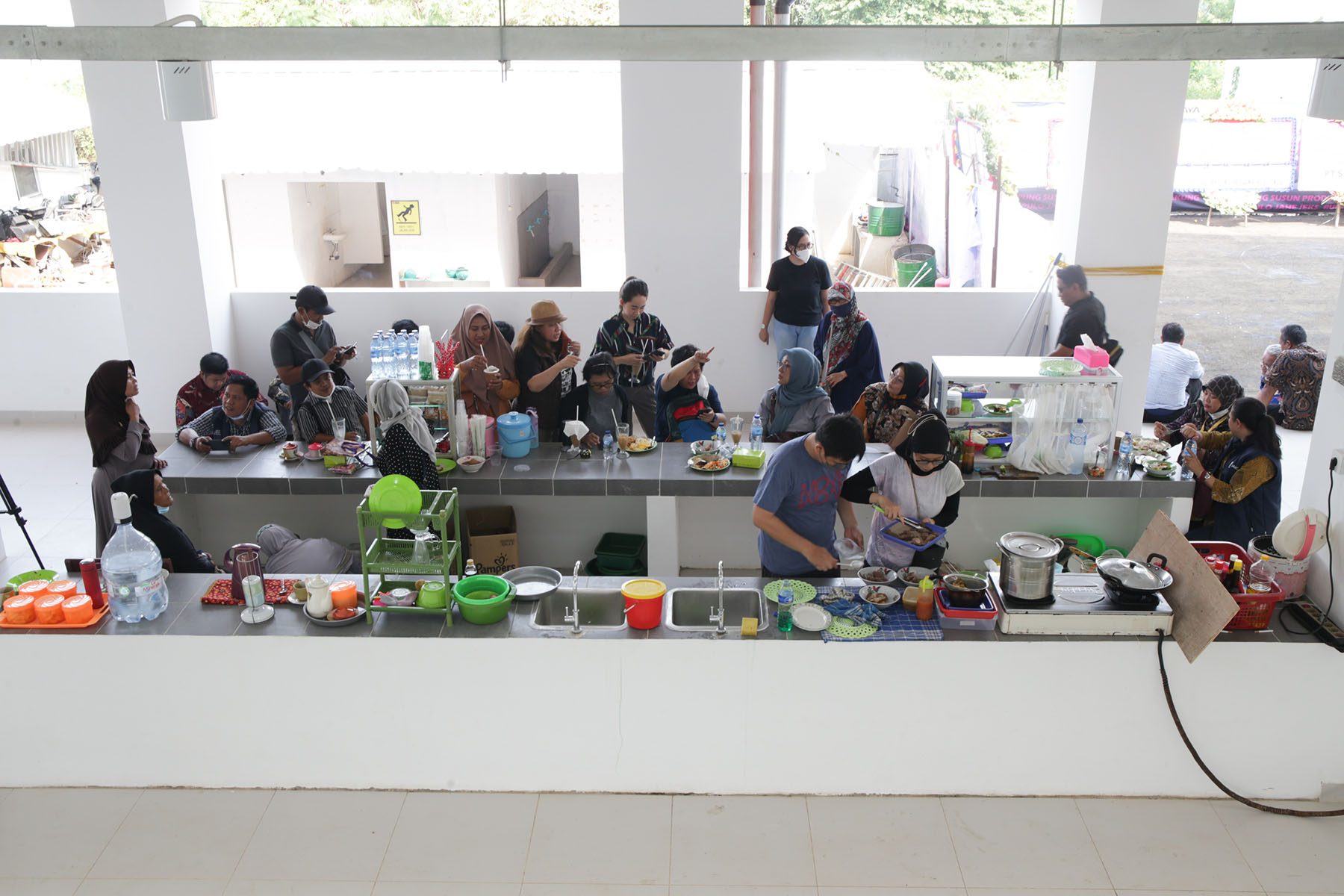
The Neighborhood Upgrading Program (NUP) in Trinidad and Tobago targets enhancing living standards and housing conditions for low and middle-income households residing in squatter settlements. Comprising three key components, the program emphasizes regularization and enhancement of squatter settlements, provision of housing grants, and strengthening institutional capacities within the Ministry of Housing and Urban Development. With criteria ensuring fair distribution and ongoing evaluation, the NUP, supported by the Inter-American Development Bank (IDB), emerges as a successful initiative addressing dire housing needs and promoting social and environmental considerations.

Date

  • 2017: Implementation

Stakeholders

  • Trinidad and Tobago’s Ministry of Housing and Urban Development
  • IDB

Location

Continent: South America
Country/Region: San Fernando

Description

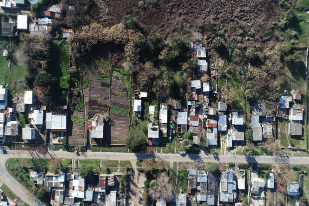
Trinidad and Tobago faces a housing deficit exceeding 100,000 units, compounded by significant squatting on state land, affecting up to 19% of the population. In response, successive governments have initiated various programs aimed at formalizing informal settlements and providing occupants with secure tenure. To address the ongoing housing needs, two partnership programs with the private sector have been launched. These involve collaborations with medium and large contractors under the Housing Development Corporation (HDC), as well as the Infill Lots program, which engages small contractors to build on vacant lots within HDC-owned developments. One of the main programs, though, is the Neighborhood Upgrading Program (NUP).

The primary objective of the NUP is to enhance the living standards and housing conditions of low and middle-income households residing in squatter settlements. This is achieved through a multifaceted approach that includes infrastructure upgrades, provision of home improvement grants, and facilitation of incremental housing construction or purchase. Additionally, the program aims to foster the creation of equitable, healthy, and sustainable communities throughout Trinidad and Tobago.

The NUP comprises three key components. Firstly, it involves the regularization and enhancement of squatter settlements, focusing on infrastructure improvements and regularization of land tenure for occupants. This aspect is overseen by the Land Settlement Agency (LSA), which operates under the authority of the State Lands (Regularization of Tenure) Act of 1998 and is tasked with legalizing illegal occupation at 254 designated sites across the country. Secondly, the program offers housing grants administered by the PMCU, which provides financial assistance to eligible low-income individuals for various housing-related purposes such as home improvements, construction, or purchases. Lastly, the NUP includes efforts to strengthen sectoral and institutional capacities within the Ministry of Housing and Urban Development and its affiliated agencies. This involves activities such as acquiring necessary hardware and software, automating program reports, and engaging in regional and international forums to exchange best practices in housing and urban development.

To qualify for grants, applicants must meet specific criteria including income limits, citizenship, property ownership or permission, and no prior benefit from housing grants. The program offers financial assistance for home construction or purchase, with varying amounts based on income levels and regional property values. Beneficiaries are selected through a random process and undergo verification interviews to ensure accuracy.

Though formal evaluation is ongoing, the IDB deems the NUP successful, having reached numerous families in dire housing need, often living in poverty. The program emphasizes social and environmental considerations and has demonstrated reasonable unit costs compared to similar initiatives. Replication of the program across Trinidad and Tobago is viable given established procedures and capacity. The Land Settlement Agency oversees squatter settlement regularization, while the Ministry has developed internal capabilities to administer housing subsidies independently.

Financing remains a challenge for project expansion, but the IDB expresses continued willingness to support such initiatives, having already provided three consecutive loans for housing and related projects in the country.

Census of homeless people in Belgium

0

Census of homeless people in Belgium

Mismatches Vulnerable groups
Policies and regulations Governance Data and monitoring Evaluation and impact

Main objectives of the project

Belgium, in alignment with the Lisbon Declaration of June 2021, is committed to tackling homelessness by 2030, emphasizing the importance of data-driven strategies. The King Baudouin Foundation, along with research teams and local authorities, has developed a standardized methodology for counting homeless individuals, spanning urban and rural areas. Initial findings surpassed expectations, totaling over 16,000 individuals. The data informs annual reports accessible to all, while qualitative interviews aim to deepen understanding and inform effective solutions.

Date

  • 2020: Implementation

Stakeholders

  • King Baudouin Foundation
  • LUCAS KULeuven

Location

Continent: Europe
Country/Region: Belgium, Leuven

Description

In June 2021, Belgium endorsed the Lisbon Declaration, pledging to address homelessness by 2030 through systemic measures. A key aspect highlighted in the Declaration is the necessity for these measures to be grounded in accurate data to effectively guide policymakers.

Since 2020, the King Baudouin Foundation has been actively involved in collaboration with research teams from UCLouvain and LUCAS KULeuven, along with over 100 local authorities, in devising a standardized methodology for counting individuals experiencing homelessness in Wallonia and Flanders. The Foundation aims to extend this methodology nationwide to ensure consistent and recurrent counts across Belgium. The Netherlands has also expressed interest in this approach, which was successfully piloted there earlier this year.

The initial census took place in Leuven and subsequently expanded to Limburg, Ghent, Arlon, and Liège. This methodology goes beyond merely tallying individuals sleeping on the streets; it encompasses the entire spectrum of homelessness classifications outlined in ETHOS Light. This broader approach considers individuals residing in institutions, unconventional dwellings, or temporary accommodations with family, friends, or acquaintances. Thus, the census delves deeper than surface-level assessments.

In 2022, efforts were made to extend the census beyond urban centers to encompass rural areas as well. In Flanders, six zones were involved: Boom-Mechelen-Lier, Bruges Arrondissement, Midwest, Middenkust, Kempen Zorgregio, and Waasland. Counts were also conducted in the German-speaking Community, Tournai, and Walloon Brabant. The combined tally from these areas exceeded 16,000 unhoused and homeless individuals, surpassing initial expectations. However, this data now provides a basis for informed action.

The findings are published annually in a comprehensive report accessible to any interested administration or individual citizen. Moreover, the census team is now conducting interviews to gain insights into the pathways to homelessness. This qualitative approach aims to inform the development of innovative solutions.

Dublin Housing Observatory

0

Dublin Housing Observatory

Policies and regulations Local policies Governance Data and monitoring Evaluation and impact

Main objectives of the project

The Dublin Housing Observatory (DHO) is a pioneering research unit within Dublin City Council, guided by an independent advisory board. It leads the council's efforts in housing, planning, economic development, inclusion, and integration, with a dedicated team reporting to senior management. Committed to providing evidence-based insights, the DHO strives to create an affordable and sustainable living environment in Dublin by fortifying housing policies with robust empirical foundations and managing crucial data on pricing, rentals, vacancies, zoning laws, etc.

Date

  • 2019: Implementation

Stakeholders

  • Dublin City Council
  • AIRO

Location

Continent: Europe
City: Dublin
Country/Region: Dublin, Ireland

Description

The Dublin Housing Observatory (DHO), a novel research unit within Dublin City Council, is steered by an independent advisory board and spearheads the council's multifaceted approach to housing, planning, economic development, inclusion, and integration. It comprises a dedicated team of three professionals under senior management's guidance, reporting to the Deputy Chief Executive in Housing and Community Services.

At its core, the DHO is committed to furnishing evidence that informs housing policy and enhances operational efficacy. Embracing its mission to foster an affordable and sustainable living environment in Dublin, the Observatory strives to fortify housing and urban development strategies with rigorous empirical foundations. It acts as a custodian of crucial data encompassing pricing trends, rental landscapes, vacant properties, and zoning dynamics.

With a clear vision in mind, the Dublin Housing Observatory delineates four primary objectives. Firstly, it aims to bolster Dublin City Council's efforts in delivering top-tier social and affordable housing solutions while nurturing sustainable communities. Secondly, it positions itself as a vibrant knowledge-exchange hub, fostering dialogue and collaboration in policy design, analysis, and implementation within the realms of housing and urban development. Furthermore, the DHO serves as a pivotal research nexus, generating insights crucial for evidence-based decision-making across housing and its allied domains, including planning, economic development, inclusion, and integration. Lastly, it assumes the mantle of a data navigator, offering stakeholders, the public, and elected representatives an objective compass through the intricate dynamics of Dublin's housing system and market.

Since its inception, the Dublin Housing Observatory has made significant strides. From the launch of a comprehensive Mapping Viewer, in partnership with AIRO and OSi, to the publication of an insightful report on the city's Rapid Build Programme, the Observatory has enriched public discourse and policymaking with invaluable data and analysis. Moreover, its contributions extend to informing strategic initiatives, supporting departmental reviews, and fostering collaborative events attended by national and international stakeholders, reinforcing its pivotal role in shaping Dublin's housing landscape.

Kampung Susun Produktif Tumbuh Cakung, Jakarta

0

Kampung Susun Produktif Tumbuh Cakung, Jakarta

Mismatches Location Security Functional adequacy Services Vulnerable groups Climate change
Policies and regulations Regulation Participatory processes
Urban Design Services and infrastructure Environments Quality Liveability Inclusion Equity Participatory processes
Ownership and tenure Shared ownership

Main objectives of the project

In response to Jakarta's sinking crisis, Bukit Duri residents faced eviction in 2016. Deemed illegal, this sparked a movement led by Ciliwung Merdeka, empowering residents to demand their rights. The result? Kampung Susun—a cooperative where former residents manage their space, integrating living and economic activities, defying traditional public housing norms, and fostering community resilience and cohesion.

Date

  • 2020: Construction

Stakeholders

  • Constructor: PT. Jaya Konstruksi Manggala Pratama Tbk.
  • Architect: STUDIO AKANOMA
  • Promotor: Jakarta City Hall
  • Promotor: Ciliwung Merdeka

Location

Continent: Asia
Country/Region: Indonesia, Jakarta

Description

Jakarta is confronted with a significant threat: the city is sinking, resulting in more frequent floods and substantial portions of the city being submerged. The most vulnerable communities are bearing the brunt of this issue. In 2016, seventy families in Bukit Duri, Jakarta, were forcibly removed from their homes as part of efforts to address the city’s chronic flooding problems. However, the eviction was subsequently deemed illegal. In 2017, the State Administrative Court ruled that the eviction lacked legal justification and that the residents were entitled to compensation. Volunteers from the organization Ciliwung Merdeka collaborated with the residents, spanning from children to adults, to empower the community through various programs aimed at fostering solidarity and self-reliance. These initiatives encompassed educational programs for children, public health education, waste management, economic empowerment, art and culture education, disaster response and mitigation, as well as spatial planning and architecture. Additionally, they collectively advocated for government recognition that impoverished citizens deserved adequate living conditions and demonstrated that viable alternatives to eviction existed.

One such alternative materialized in the form of the Kampung Susun new residence and cooperative, where residents themselves assume responsibility for the neighborhood's upkeep. Tenants are not required to pay rent but are obligated to contribute a maintenance fee to the cooperative, which also has the capacity to provide residents with business capital. The design process began with identifying spaces tailored to the economic development needs of former Kampung Bukit Duri residents, the majority of whom are engaged in the informal business sector and own small enterprises. The design concept emulates the urban settlement model, featuring small houses with dedicated economic spaces, giving rise to the term "kampung susun." Notably, Kampung Susun stands out from Jakarta's conventional public housing projects, known as rusunawa, which typically lack provisions for business activities. Each residential unit in Kampung Susun encompasses both living and economic spaces, with communal areas on the ground floor enabling residents to engage in commerce. Additionally, residents have the opportunity to expand their living quarters vertically, facilitated by a mezzanine level within each unit.

Measuring 36 m2 in total, with 21 m2 designated for private use and 15 m2 allocated for business or workspace, each residential unit is designed to accommodate growth. This innovative approach to urban settlement, known as Kampung Susun Produktif Tumbuh, or growing, productive stacked kampong, addresses the challenges of densely populated urban environments and the limitations of traditional housing construction. Beyond serving as mere dwellings, Kampung Susun fosters a sense of community where residents can engage in economic activities and foster friendly interactions, recognizing the distinct characteristics of urban settlement inhabitants compared to those residing in the outskirts of the city.

The case is undoubtedly a resilient solution to an unprecedented climate problem. Bottom-up and from the community, it solves a huge challenge of obtaining public housing in an adverse context, promoting the productive economy of its residents.

Settlements Observatory, Montevideo

0

Settlements Observatory, Montevideo

Policies and regulations Local policies Governance Data and monitoring Participatory processes
Promotion and production Favelas/Slums

Main objectives of the project

In 2017, Montevideo created the Settlements Observatory. The objective was to have an instrument of information and public data on the biggest challenge the city faces: achieving livable environments for its most vulnerable communities, but maintaining its idiosyncrasy.

Date

  • 2017: Implementation

Stakeholders

  • Montevideo municipality - divisiontierrasyhabitat@imm.gub.uy

Location

Continent: South America
Country/Region: Montevideo, Uruguay

Description

Montevideo today has more than three hundred informal settlements. They are inhabited by more than 120,000 people, most of them from vulnerable communities. This is the result of years of urban growth in a context of economic crisis and years of migration and uncontrolled urban sprawl. Thus, the city lived and lives a deep urgency. There is an urgent need to integrate these neighborhoods. But to do so, the magnitude of the problem must be known.

In the previous decade, it was unknown how many people lived in settlements (beyond census data), there was no knowledge of the status of the interventions, nor was it recorded in a unified way. For this reason, in 2017 the Settlements Observatory was created. This instrument aims to systematize the main indicators of the city's settlements. Thus, it aims to put data to the reality of the settlements, seeing their realities and differences. Moreover, it does it in a systematic and longitudinal way, being able to monitor its evolution. In this way, it becomes the evaluation and follow-up instrument for Montevideo's neighborhood improvement programs. The information related to irregular settlements includes data on interventions carried out by different agencies and institutions. This allows their categorization, as well as establishing whether or not the conditions of the definition of irregular settlement are maintained or not, in order to maintain or remove them from the database, respectively.

Each settlement collects a series of simple and mapped data in the metropolitan environment of Montevideo. Mainly, each settlement has a name, the area, the number of inhabitants, the status (intervened or not), the plan that intervenes in it and the number of dwellings. It is also possible to find out if they are in the process of regularization or not and since when or if their inhabitants have been relocated. All this makes it possible to follow up on people living in low climatic comfort, in sub-standard housing and to systematize the programs that have an impact on their environment.

One of the most important issues of the observatory was to be an instrument of transparency. Thus, in addition to influencing and improving programs, it also transfers information to interested agents, affected communities and other administrations on the work being carried out and the state of the situation. This transparency exercise is essential to encourage participation in the programs and build trust. The open data system also allows the intervention of universities, researchers and those interested in the subject, helping to delve deeper into the realities of the settlements.

In addition, the communities are also a vehicle for information. The observatory's ultimate goal is to ensure that these communities can also become empowered by the realities of their environments.

Observatorio de la Vulnerabilidad Urbana, Spain

0

Observatorio de la Vulnerabilidad Urbana, Spain

Mismatches
Policies and regulations National policies Governance Data and monitoring Evaluation and impact

Main objectives of the project

The Spanish Ministry of Housing Development realized that, despite having systematized housing census data, it had not systematized the information to make informed affordable housing and neighborhood improvement policies. For this reason, it has created the Observatory of Urban Vulnerability. The objective of this observatory is to inform through an open data system the information available from the Spanish administrations on residential insecurity, unaffordable housing or urban deprivation.

Date

  • 2015: Implementation

Stakeholders

  • Ministerio de Fomento (Spain)

Location

City: Madrid
Country/Region: Spain

Description

Spanish cities are facing an unprecedented housing crisis. Added to this is an aging housing stock, most of which is owned but whose inhabitants do not have the capacity to rehabilitate the buildings. In this way, Spain sees how the social crisis is added to the housing crisis, giving rise to significant urban vulnerabilities and growing residential insecurities. For this reason, it wanted to promote various programs to help alleviate this situation. The problem was (and is) that there is no systematized, open and worked data on these matters. Hence the Observatory of Urban Vulnerability was born.

The Observatory manages 2 atlases or data visualizations. One is directly related to housing. It is the Atlas of Residential Building in Spain, with information on the characteristics of residential buildings and housing at the census section level of all Spanish municipalities (referring to the Population and Housing Censuses of 2001, 2011 and 2018). The indicators range from income to the state of housing in the last two decades. All of this is delimited in census sections, the smallest delimitation that Spain has, comparable to neighborhoods.

The other atlas is that of Urban Vulnerability. In this case, the Observatory relates the housing situation with the socioeconomic and demographic characteristics of its inhabitants. In this way it can generate an index of urban deprivation for the whole state, detecting which locations will have the most difficulties in the future to live in adequate living conditions.

Apart from the visualization of the data, the observatory reports on them. All the data it generates is open to the public and easy to consult. In fact, the objective is to be used by other administrations and researchers as a reference in the field in the state. From there, to share diagnoses and common actions in urban regeneration. This fact is especially important in Spain, whose competencies in housing are the responsibility of the Autonomous Communities (regions and nations of the State) and not the central government. Thus, the observatory can be a support point for common information and coordination. It is being so for the development of the Urban Agendas.

Although it is not exclusively a housing observatory, it has an impact on the capacity of inhabitants to access housing and its characteristics. In this way, it is a vital instrument for their policies.

Housing Observatory, Vitoria, Euskadi

0

Housing Observatory, Vitoria, Euskadi

Mismatches
Policies and regulations Local policies Data and monitoring Evaluation and impact

Main objectives of the project

Responding to the pressure of the real estate market, Vitoria-Gasteiz has created a powerful Housing Observatory. This observatory, unique for a city of its size, integrates fragmented data from various sources into a single, accessible visualization. Thematic maps provide a detailed overview of the rental market, land availability and the general state of housing, all contextualized by the socioeconomic situation of neighborhoods. A tool that democratizes access to vital information to guarantee the right to housing.

Date

  • 2020: Implementation

Stakeholders

  • Vitoria-Gasteiz City Council

Location

Continent: Europe
Country/Region: Spain, Vitoria-Gasteiz

Description

Vitoria-Gasteiz is a medium-sized city in Spain. Despite being the capital of the Basque Country, it is the smallest city of the three provinces that make up the Autonomous Community. Vitoria-Gasteiz is known for being a city that has invested a lot in being a green reference and urban regeneration of its neighborhoods. Despite this, it suffers tremendous pressure from the real estate market, which causes it to live in an unprecedented housing crisis. For this reason, the Housing Observatory was created. Among Spanish cities, it is possibly one of the most powerful observatories in existence. Especially when taking into account that it is from a medium-sized city, which is an uncommon place to have these information platforms. Its main objective is to have an open data tool and cartographic visualization of the main housing indicators.

Before the implementation of the Housing Observatory, the information was fragmented in various administrations and entities. Thus, the main task of the Observatory is to collect, systematize, update and relate data from various sources in a single visualization. All the information is oriented to inform the real estate sector, citizens mobilized by the right to housing and administrations about the main state of housing in Vitoria-Gasteiz.

The data are organized in thematic maps. Mainly, the rental market, new and used housing, land available for construction and the general state of the housing stock stand out. Around these maps you can find the average prices of housing, its condition or where new buildings can be built, public or private ownership. Everything is put in relation to the socioeconomic situation by neighborhoods, helping the idea of urban regeneration and encouraging more diverse neighborhoods with mixed uses. In addition, there is a visualization of the main indicators, which can be filtered by neighborhoods. Thus, it also provides a global and territorialized vision, beyond the thematic maps.

All this information can be downloaded and used freely by any user. In short, a tool for the democratization of housing data to coordinate actions to guarantee the subjective right to decent and affordable access to housing.

Mapping the vacant buildings of the center, Constanta, Romania

0

Mapping the vacant buildings of the center, Constanta, Romania

Mismatches Vacant housing
Policies and regulations Local policies Data and monitoring Evaluation and impact

Main objectives of the project

In Constanta's historic city center, there exists a notable abundance of deteriorated and unoccupied buildings. To systematically identify, catalog, and spatially represent these structures, as well as to devise and oversee strategies for their revitalization, Constanta has developed an urban planning database utilizing a Geographic Information System (GIS), specifically ArcGIS. Leveraging GIS enables the conduct of various analyses and the visualization of outcomes through mapping techniques. This database serves as a centralized repository for pertinent data concerning these buildings and their surroundings, facilitating access for key stakeholders.

Date

  • 2018: Implementation

Stakeholders

  • Constanta City Hall

Location

Continent: Europe
Country/Region: Constanța, Romania

Description

Constanta, the fourth largest city in Romania and a pivotal port on the Black Sea, boasts a rich history and serves as a prominent tourist destination and commercial hub. Despite its historical significance, the city has encountered a pressing issue within its core: the decline of its historic center, marked by dwindling population and numerous vacant buildings in urgent need of restoration. In response, the city initiated the ALT/BAU URBACT project to address this challenge head-on.

The initial hurdle was the lack of comprehensive data to guide solutions. To remedy this, a meticulous process was undertaken to compile a vast dataset encompassing every housing unit within the historic center. This involved collating diverse sources of information from various city departments, including urban development, heritage, local police, as well as public service and autonomous regimes governing public and private domains.

A crucial aspect of this data-gathering effort was the monitoring of building conditions and vacancy status. The local police department played a pivotal role in classifying and tracking degraded buildings, issuing notifications to owners and setting deadlines for rehabilitation. Failure to comply could lead to significant penalties, including increased property taxes of up to 500%.

Additionally, technical datasheets for each building were meticulously developed by volunteer junior architects and technical experts. These datasheets, enriched through field visits and collaboration with owners, contained vital information such as architectural style, construction year, and current condition.

The integration of this data into the ArcGIS desktop application platform facilitated systematic organization and regular updates, ensuring its accessibility to relevant stakeholders, particularly building owners.

Crucially, the database not only provided insights into building conditions but also encompassed broader contextual information essential for urban renewal efforts. This included infrastructure rehabilitation plans, municipal programs for building facades and roofs, as well as proposals from citizens, NGOs, and specialists.

As we briefly mention, leveraging this comprehensive dataset, the city implemented effective policies such as taxing vacant buildings. Through GIS-enabled classification, buildings were identified as either neglected, subject to fines without property tax increases, or neglected with potential tax hikes of up to 500%. The imposition of such measures incentivized rehabilitation efforts, prompting some owners to commence repair works or sell properties to willing investors.

Moreover, for listed buildings, collaboration with monument protection authorities ensured preservation and restoration measures were advised, underscoring the importance of heritage conservation within the urban renewal framework.

This case exemplifies how robust diagnosis and data-driven approaches can catalyze efficient policy interventions, revitalizing urban spaces and buildings, fostering affordable housing and preserving cultural heritage.

Habitatge Metròpolis (HMB), Barcelona

0

Habitatge Metròpolis (HMB), Barcelona

Policies and regulations Local policies Global frameworks Governance Public-private initiatives
Financing Public funding Public-private collaboration
Promotion and production Public-private partnerships
Ownership and tenure Protection of social housing Public-private partnerships

Main objectives of the project

Habitatge Metròplis is the metropolitan operator for the promotion of public housing. A mixed public-private company that seeks to build social housing in a profitable way for the private company. Its greatest advantages are 1) the innovative governance it assumes and 2) its metropolitan dimension.

Date

  • 2019: Implementation

Stakeholders

  • Promotor: Barcelona City Council
  • Promotor: Metropolitan Area of Barcleona (AMB)
  • Promotor: Neinor Homes, S.A

Location

Continent: Europe
City: Barcelona
Country/Region: Barcelona, Spain

Description

Barcelona is facing the biggest housing crisis in recent years. In the capital and its metropolitan area, rents are much higher than in the rest of the country. This is causing applications for social housing to skyrocket. Despite this, the number of social housing units in Barcelona is well below the European average and is falling. This is due to the fact that for years, social housing was under ownership regime. That is, after a few years it ceases to be protected and goes to the free market. Thus, there is a need to build social housing quickly and in large quantities.

Unfortunately, the administration alone could not cope with the great demand. That is why they have decided to promote a metropolitan operator. That is to say, they have created a mixed company, between the public and private sectors, to promote social housing for the metropolitan area of Barcelona. The goal is to build 4500 homes in 6 years, 50% within the city of Barcelona and 50% in the metropolitan area. The shareholders of the company are the AMB (25%), the Barcelona City Council (25%), the company NICRENT Residencial (50%), of which Neinor Homes, S.A. and CEVASA are 50% shareholders. The balance between public and private partners and the relationship of equality, co-responsibility and long-term trust is the basis for sharing investment efforts, risks, costs and benefits. This formula guarantees the social goals of the project and its economic success, taking into account the technical capabilities and economic solvency of the participating partners.

Unlike in the past, all the housing will be for subsidized rental at below-market prices and will always be publicly owned. In this way, the land will remain under social housing protection, despite the passage of time. With regard to construction, the operator must guarantee environmental quality and sustainability with energy saving criteria and promote accessibility and architectural quality.

It is the first company of its kind to have a metropolitan dimension in Spain. In fact, Spain has a high deficit of metropolitan housing policies. A study has detected 384 institutions operating in Spain's metropolitan environments. Of these, only about 30 deal directly or indirectly with the issue of housing, despite being one of the main problems of Spanish cities (1). Thus, the operator is innovative because it assumes, for the first time, that housing does not have a municipal dimension, but goes beyond its limits. In this way, its metropolitan approach is vital for developing a joint housing policy among the 36 municipalities that make up the Metropolitan Area of Barcelona.

(1) To see more into: Tomàs, M. (2023). Metrópolis sin gobierno. La anomalía española en Europa. Ed. Tirant lo Blanch.

Links

Masoveria Urbana, Vilafranca, Spain

0

Masoveria Urbana, Vilafranca, Spain

Mismatches Vulnerable groups Vacant housing
Policies and regulations Local policies Regulation Participatory processes
Promotion and production Private promotion Self-management
Ownership and tenure

Main objectives of the project

In the global North, there's often a misconception that access to affordable housing is limited to either ownership or renting. However, historical precedents suggest otherwise. Vilafranca leveraged an ancient land ownership and possession scheme permitted by their traditional private law to devise a solution for affordable housing: the concept of "masoveria”. In Catalan tradition, "masoveria" entails an agreement wherein a property owner grants the use of a house in the countryside to a tenant at no cost. In return, the tenant assumes responsibility for maintaining and cultivating the land and fields associated with the property. This concept has been adapted in urban contexts through initiatives known as "Urban Farmhousing" or "Masoveria Urbana." In these initiatives, buildings in need of renovation and often left vacant are temporarily leased by the owner to tenants at no charge. In exchange, the tenant undertakes necessary rehabilitation works to improve the property.

Date

  • 2017: Implementation

Stakeholders

  • Vilafranca City Council

Location

Continent: Europe
Country/Region: Spain

Description

Vilafranca del Panadès, located in the same region as Barcelona, is considered part of its metropolitan area despite its position on the frontier with the countryside. As the capital of wine in Catalonia, Vilafranca boasts a rich tradition of agriculture. Interestingly, this tradition has become pivotal in addressing the city's urban challenges.

Within the framework of the ALT/BAU URBACT network, Vilafranca identified a significant number of vacant buildings in its city center. The objective was to restore these buildings to tackle the city's most pressing issue: the housing crisis. Following the economic downturn of 2008, finding affordable housing in Vilafranca became increasingly difficult, with prices soaring. Meanwhile, many vacant buildings remained in need of refurbishment, offering potential solutions that could benefit younger residents.

In the rural areas surrounding Vilafranca, there exists a particular type of unused contract known as Masoveria. Under this arrangement, a landowner grants a "masover" the use of the land for agricultural purposes, allowing the landowner to retain ownership while the "masover" benefits from cultivating the land. Recognizing the potential application of this concept in the housing sector, Vilafranca sought to adapt it to their urban challenges.

The proposed solution operates on a simple premise: property owners lacking the financial means to renovate their vacant buildings lease them to younger individuals, who take responsibility for refurbishing the properties. In exchange, the tenants have the right to use the house unit with the condition of improving it. This arrangement not only addresses the housing crisis by providing access to housing without exorbitant costs but also benefits property owners by ensuring their properties are maintained and improved.

This system allows people without house to access one (without paying the market prices!). And then, people with vacant houses earn someone maintaining it and improving it. Central to the success of this initiative is the support of the local council. The municipality actively promotes this model through its website and press releases, maintaining a list of interested owners and tenants. Potential matches are facilitated through initial meetings, with the municipality offering assistance in drafting leasing contracts and navigating the process. Additionally, the municipality serves as a mediator if necessary, fostering collaboration between owners and tenants.

To further promote awareness and engagement, the city council organizes festivities in areas with vacant buildings, featuring music and family events on weekends. These events aim to attract citizens to these areas, allowing them to explore the vacant buildings and appreciate their heritage value. Ultimately, the goal is to empower citizens to make use of these opportunities and contribute to the revitalization of these spaces.

This project exemplifies two key insights: firstly, the innovative utilization of traditional legal frameworks to provide affordable housing without significant public expenditure, and secondly, the proactive role of the public sector in facilitating collaboration among stakeholders, positioning it as a leader in urban development rather than merely a provider of services.