Social Housing in Magaluf, Mallorca

0

Social Housing in Magaluf, Mallorca

Mismatches Cultural suitability Diversity Vulnerable groups Climate change
Urban Design Services and infrastructure Environments Quality Liveability Inclusion
Promotion and production Public promotion Materials

Main objectives of the project

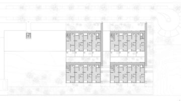
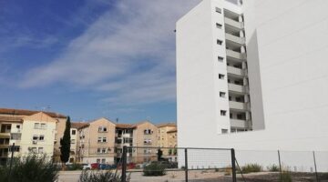
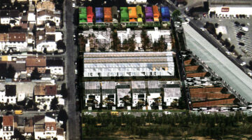
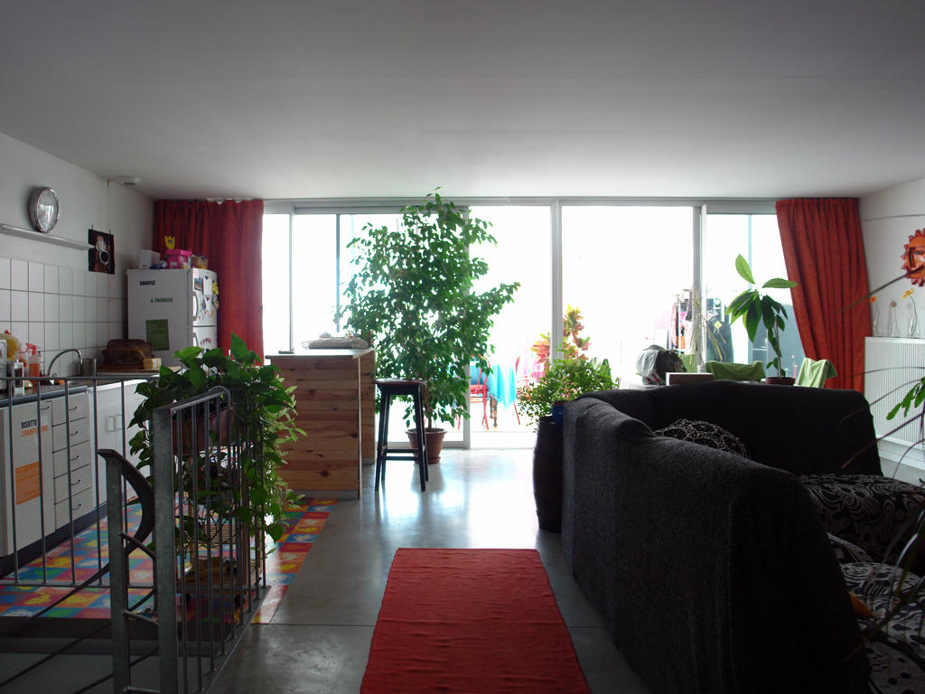
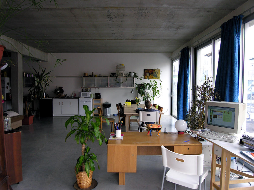
The project aims to build 48 public housing units and an underground car park in Magaluf, Calvià. It arises from a collaboration between the Balearic Housing Institute and the Calvià City Council, with each entity managing 24 homes. Organised in two south-facing enclosures, the design seeks to optimise solar exposure and natural ventilation. This project focuses on sustainability, integration into the coastal environment and improving the quality of life in one of the most residentially segregated areas of the island, promoting social cohesion and sustainable development in a predominantly tourist area.

Date

  • 2022: Construction

Stakeholders

  • Architect: LLOC Arquitectes
  • Promotor: IBAVI
  • Promotor: Calvà City Council

Location

Continent: Europe
City: Palma de Mallorca
Country/Region: Palma de Mallorca, Spain

Description

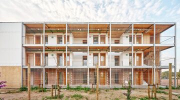
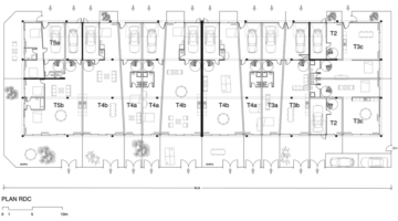
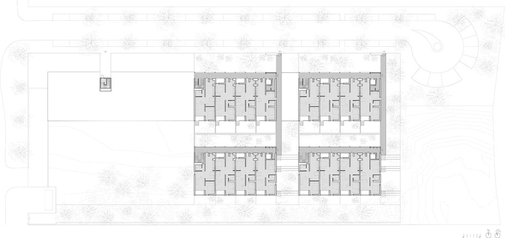
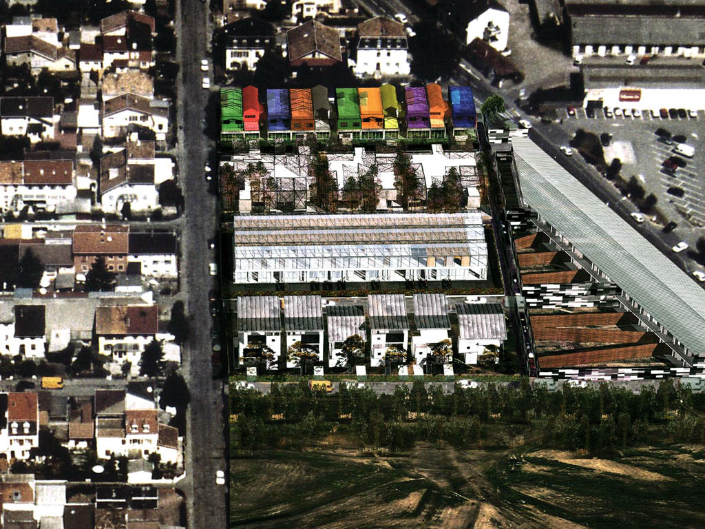
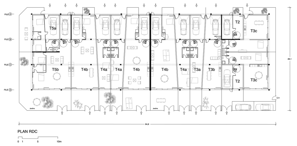
The commission consists of the construction of 48 public housing units and an underground car park in the area of Magaluf, Calvià, a municipality located in the south of the island of Mallorca, Spain, known for its coastal character and its urban fabric dominated by hotel and leisure typologies typical of the tourist model. This area is one of the most residentially segregated on the island and has clear urban development deficits. The project arises from a collaboration agreement between the Balearic Housing Institute and Calvià Town Council, assigning the management of 24 dwellings to each entity.

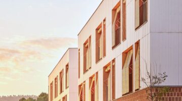
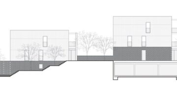
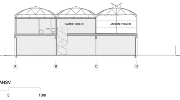
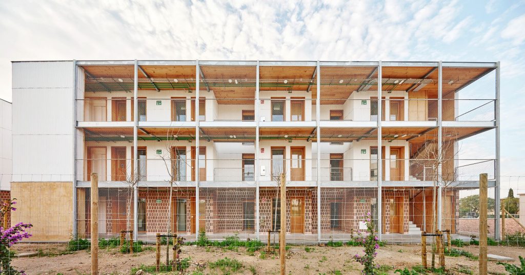
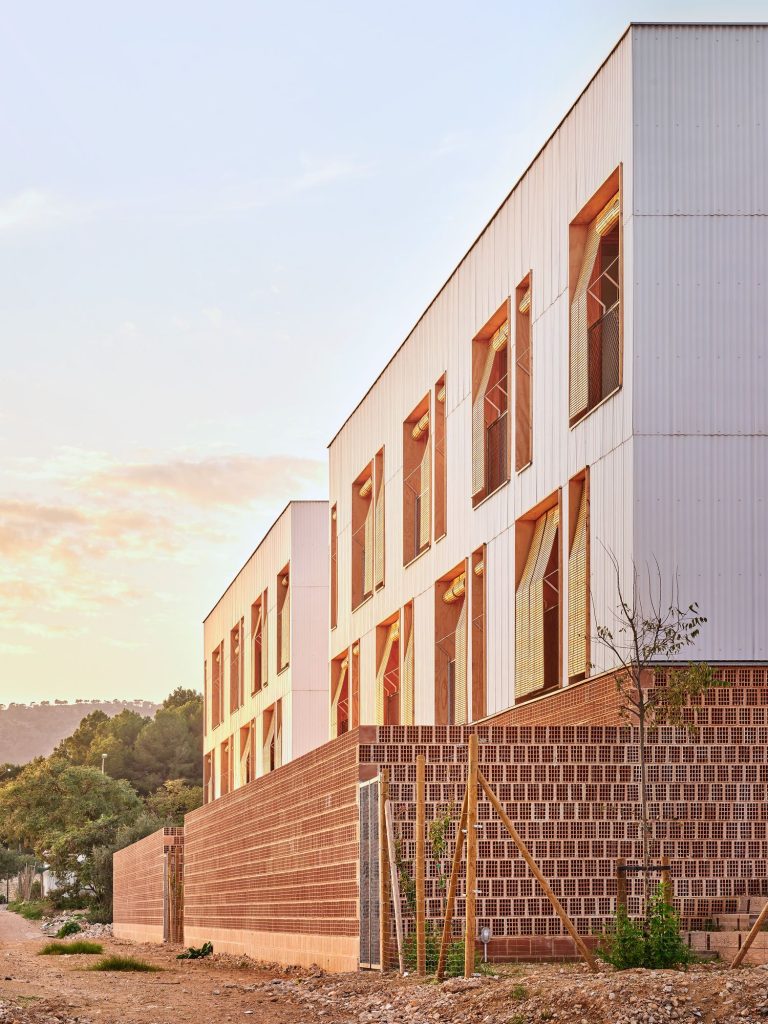
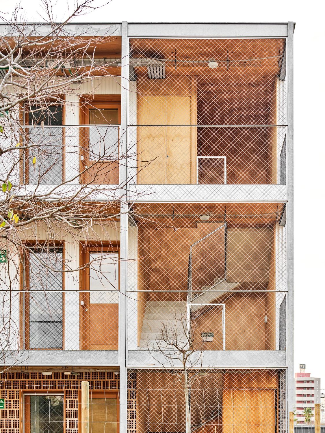
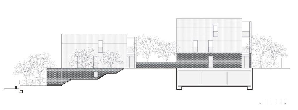
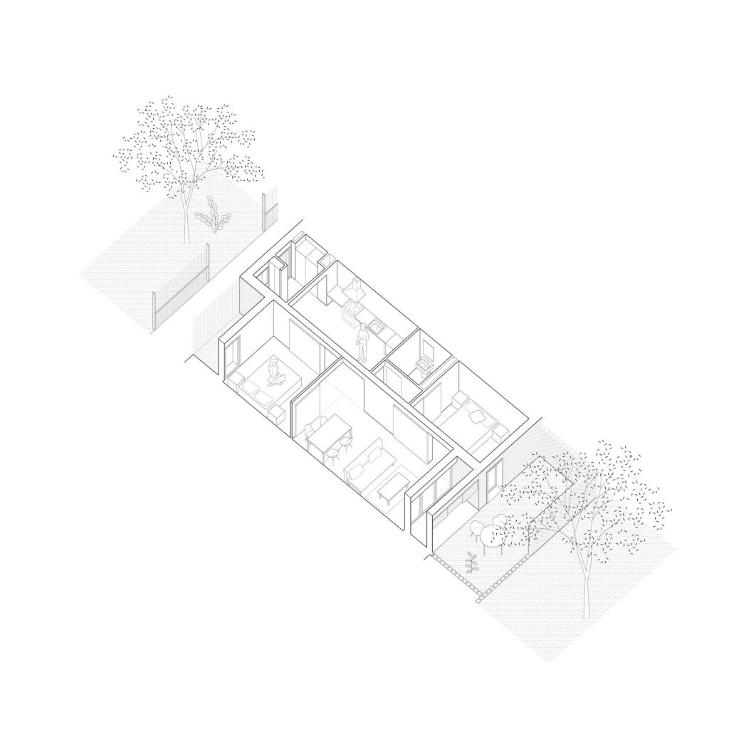
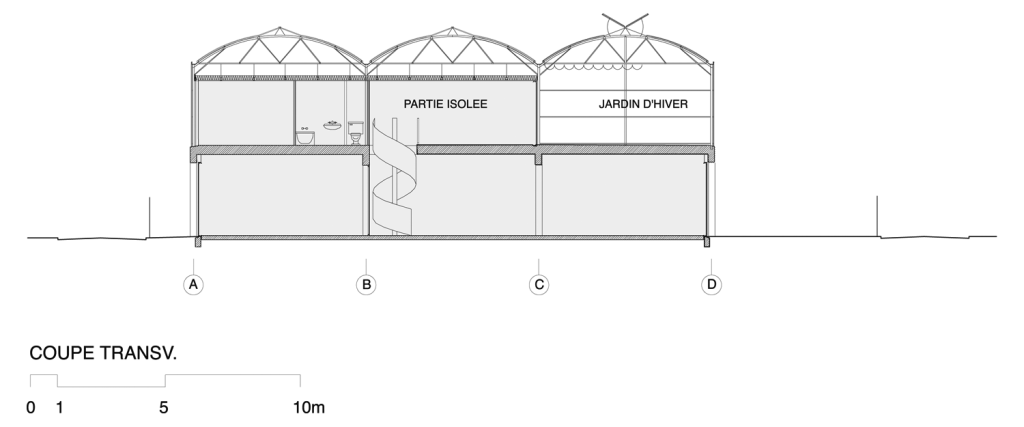
The proposal is organised in two precincts connected by an underground car park, with 24 dwellings distributed in two ground floor blocks plus two additional levels (ground floor+2) of 12 dwellings each. On the ground floor, the volumes are south-facing to maximise solar exposure and take advantage of the sea breezes. In section, a difference in height is generated between blocks that favours natural lighting and cross ventilation, minimising the visual impact and avoiding the screen effect.

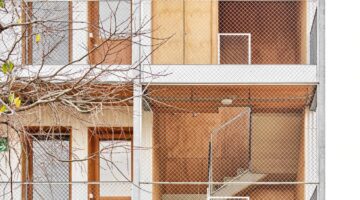
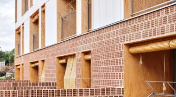
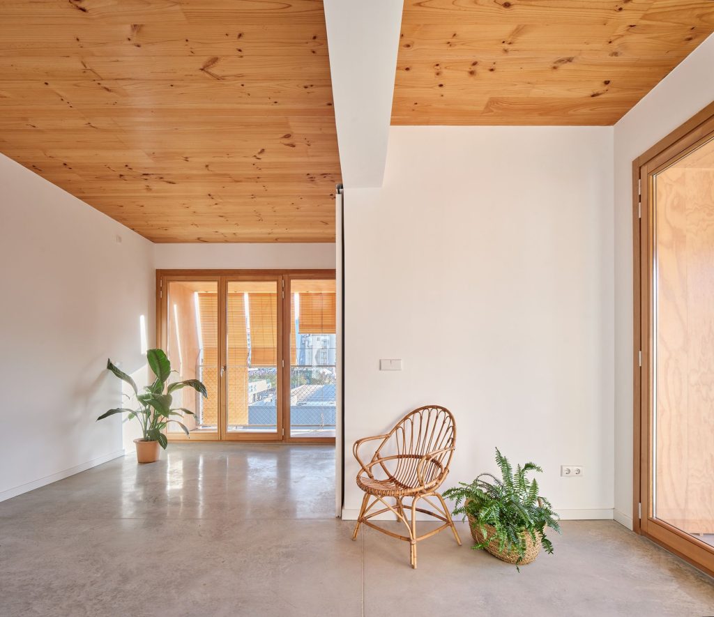
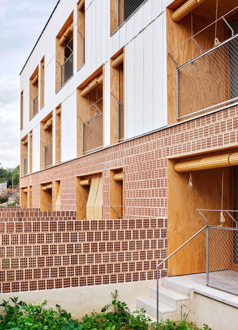
The choice of construction materials follows criteria of sustainability and environmental impact. Locally manufactured brick walls are used on the ground floor, while on the upper floors walls are made of plywood, an organic, lightweight material which, in addition to reducing construction time and waste, generates healthy spaces with a positive environmental impact.

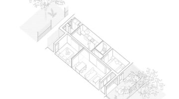
All the houses are oriented from south to north, coinciding with the direction of the prevailing winds. They have patios on the ground floor and terraces on the upper levels. Cross-ventilation is enhanced by the appropriate sizing of the openings, and solar radiation control and privacy is ensured by a system of roller blinds.

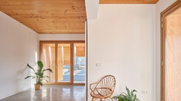
The use of passive design strategies that promote energy savings, the choice of materials with low environmental impact and spatial flexibility are the fundamental pillars on which these wood-framed, energy class A dwellings are built. The various typologies seek a diagonal connection of spaces through large interior openings and sliding doors, generating flexible spaces that adapt to the life cycle of the users.

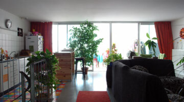
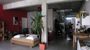
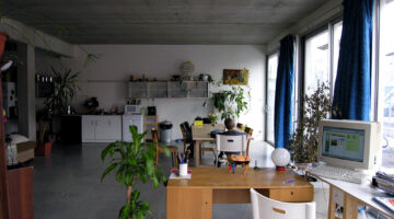
The importance of a quality social housing project, integrated into the surroundings and respectful of the environment, is crucial in an area as touristic as Magaluf. This type of initiative not only improves the quality of life of the residents, but also contributes to social cohesion and the sustainable development of the community.

Pla de Barris, Barcelona

0

Pla de Barris, Barcelona

Mismatches Functional adequacy Services Cultural suitability Vulnerable groups Climate change
Policies and regulations Local policies Building capacity Global frameworks Governance Public-private initiatives

Main objectives of the project

The Pla de Barris in Barcelona adopts a holistic approach to affordable housing, emphasizing not only the refurbishment of housing and public spaces but also addressing economic and social justice issues within neighborhoods. Originating in the early 2000s and reimplemented in 2015 with a community-driven focus, the plan supports local initiatives with institutional help, fostering collective action. It integrates housing actions with economic development, educational opportunities, and social services to enable residents to afford their living costs. Currently, the AMB is preparing to expand this initiative to a metropolitan level, ensuring broader impact across the entire city.

Date

  • 2015: Implementation

Stakeholders

  • Foment de Ciutat
  • Ajuntament de Barcelona

Location

Continent: Europe
City: Barcelona
Country/Region: Barcelona, Spain

Description

When we speak about affordable housing, we often focus solely on the buildings. This brick-and-mortar perspective, while necessary, is only a small part of the whole issue. Dwelling is not just about having access to a housing unit with an affordable cost; it also involves having the opportunity to progress professionally and personally within the neighborhood, thereby being able to manage the cost of living. This is the logic behind "el Pla de Barris" (neighborhood plan) in Barcelona.

The Pla de Barris takes a holistic approach to addressing the needs of the most deprived areas in the city. While emphasizing the necessity of housing refurbishment and enhancement of public spaces, it also addresses the economic and social justice issues within neighborhoods. Thus, the plan combines housing initiatives with social policies.

The origin of the Pla de Barris dates back to the early 2000s, focusing on the need to foster investments in public spaces where vulnerable populations lived. However, after the 2008 crisis, the Pla de Barris was cut off due to budgetary reasons. In 2015, it was reimplemented with a different perspective. Now, the Pla de Barris is community-driven, centering on actions that the community can implement themselves with institutional support. Hence, it has transformed into a collective action policy. For example, despite its investment in housing refurbishment, it does so with a holistic approach. While the public administration typically just offers a grant, the Pla de Barris also provides the tools for the community to manage the grant and implement the project (see “Finques d’Alta Complexitat” on this same website).

Additionally, living in a neighborhood means having the earnings to pay for your house and expenses. For this reason, the latest Pla de Barris emphasizes the need to foster economic development projects, educational opportunities, and social services. In addition, it puts the climate resilience of housing and neighbourhoods as a central objective, adapting the most vulnerable to the climate challenge in their homes and environments.

The Pla de Barris operates within the municipality of Barcelona. However, the AMB, the metropolitan government, is now preparing the metropolitan Pla de Barris, so that investments can be scaled to the required dimension, impacting the entire city.

Observatoire de l'habitat, Luxembourg

0

Observatoire de l'habitat, Luxembourg

Mismatches
Policies and regulations Governance Data and monitoring Evaluation and impact

Main objectives of the project

Given the skyrocketing housing prices in Luxembourg, the Housing Observatory (Observatoire de l'habitat), established in 2003, plays a crucial role in informing housing policy and public awareness. It monitors property and land prices, analyzes housing dynamics, and studies socio-economic aspects of housing affordability. The Luxembourg Institute of Socio-Economic Research (LISER) partners with the Observatory to support its research and policy planning efforts.

Date

  • 2003: Implementation

Stakeholders

  • LISER (Luxembourg Institute of Socio-Economic Research)
  • Département du Logement du Ministère des Classes moyennes, du Tourisme et du Logement

Location

Continent: Europe
Country/Region: Luxembourg, Luxembourg

Description

Given the skyrocketing housing prices in Luxembourg, the establishment of a dedicated observatory has become crucial. In fact, Luxembourg has one of the most expensive housing markets in Europe. This poses a threat to its most vulnerable population. Thus, to solve it, the first step is to have the whole information about the housing situation.

In 2003, the Housing Observatory (Observatoire de l'habitat) was set up within the Housing Department of the Ministry of Small and Medium-sized Businesses, Tourism, and Housing to produce the information needed for effective housing policy planning and to inform the public about housing issues. Since its inception, its objective has been to collect, analyze, and disseminate information on housing. It also assists the Ministry of Housing and Spatial Planning in planning housing policy. The Housing Observatory is particularly responsible for monitoring property prices, rents, and land prices. Additionally, it analyzes land dynamics in the Grand Duchy of Luxembourg, conducts a census of building land for housing, and studies housing production dynamics. Furthermore, the Observatoire de l'Habitat examines the socio-economic aspects of housing issues, including housing affordability and the impact of public policies on housing costs.

The Luxembourg Institute of Socio-Economic Research (LISER) is a key partner of the Ministry of Housing and Spatial Planning in fulfilling the tasks of the Observatoire de l'Habitat. This public research center's mission is to conduct fundamental and applied research in the social sciences to advance knowledge, inform the actions of public authorities and socio-economic players, and educate society. Thus, as one of his objetives, is the responsible to collect and process the data of the Observatory. By doing so, a scientific approach is introduced to the Observatory. As a result, the open data can be consulted at their web regarding housing matters.

Système d'information géographique de la politique de la ville

0

Système d'information géographique de la politique de la ville

Mismatches Vulnerable groups
Policies and regulations Governance Data and monitoring Evaluation and impact

Main objectives of the project

The "SIG de la politique de la ville" is an advanced online atlas that provides detailed statistical data and monitors policy implementation in France's priority urban regeneration neighborhoods, ensuring effective tracking of housing affordability and urban deprivation.

Date

  • 2015: Implementation

Stakeholders

  • Ministère de la Transition écologique et de la Cohésion des territoires
  • Agence nationale de la cohésion des territoires

Location

Continent: Europe
Country/Region: France

Description

France has long recognized the challenges faced by its vulnerable urban areas and has taken proactive measures to ensure housing affordability while addressing the social issues in its most deprived neighborhoods. To effectively implement these measures, access to reliable information is crucial. This need led to the creation of the “SIG de la politique de la ville.”

The “SIG de la politique de la ville” is an online atlas that compiles statistical and policy information about the “quartiers prioritaires de la politique de la ville” (Priority Zones for City Policies). These are areas identified for active urban regeneration policies.

Before 2014, two distinct urban policy priority areas coexisted: the regulatory area, which generated tax benefits (known as the ZUS area), and the contractual area, which generated funding (or “Cucs” area). These intervention methods did not necessarily overlap. The law on programming for cities and urban cohesion, enacted on February 21, 2014, reformed the geographic prioritization of urban policy. Using income as the sole criterion, new priority neighborhoods were identified in mainland France, La Réunion, and Martinique through a detailed territorial grid. This method was adapted for the overseas territories and revised in 2024.

As a result, 200 priority neighborhoods were identified by the decree of March 27, 2015, focusing on areas with significant urban dysfunctions, which became priorities for the new national urban renewal program. In 2024, a new delimitation process is underway.

The SIG system monitors the implementation of renewal programs and tracks the evolution of statistical data in these neighborhoods. On the website, users can select an address or region to see the priority neighborhoods within that area. By selecting these neighborhoods, users can access 1) basic statistical information on urban deprivation, 2) details of implemented plans, and 3) the progress of these plans.

This SIG tool is among the most advanced systems globally for tracking neighborhood affordability and deprivation.

Downtown rehabilitation of Santiago de Compostela, Spain

0

Downtown rehabilitation of Santiago de Compostela, Spain

Mismatches Services Cultural suitability
Policies and regulations Local policies Global frameworks
Urban Design Modelos De Ciudad Urban fabrics Environments Quality Liveability

Main objectives of the project

Santiago de Compostela, the historic capital of Galicia, faces the challenge of rehabilitating its medieval centre, protecting its heritage and avoiding the displacement of residents due to the influx of pilgrims on the Camino de Santiago. Since the 1990s, a comprehensive programme has improved housing, facilities and public spaces, prioritising residential use and creating green corridors and pedestrian areas. These initiatives, financed in part by public-private partnerships, have raised the quality of life and fostered greater cultural identification and heritage conservation.

Date

  • 1994: Implementation

Stakeholders

  • Concello de Santiago de Compostela

Location

Continent: Europe
Country/Region: Spain

Description

Santiago de Compostela, the capital of Galicia, a region within Spain, is a medium-sized but ancient city. It has about 100,000 inhabitants. Known especially for being the final destination of the Camino de Santiago, Compostela is one of the main destinations for the Catholic community. This attracts many pilgrims and visitors, which has an impact on housing prices. This is particularly noticeable in its centre, where it faces the challenge of rehabilitating very old houses (some of medieval origin), protecting the heritage and ensuring that neighbours are not displaced. Hence, in the 1990s, a comprehensive rehabilitation programme was put in place, which sought to act on housing, neighbourhoods and neighbourhood support policies to enable a thriving city centre.

The main objective of the upgrading and recovery actions in the historic centre of Santiago has been to stabilise and improve the quality of life of the resident population. Therefore, the interventions have prioritised residential use as the central objective in the historic city, implementing comprehensive housing rehabilitation programmes.

These actions have been complemented by improvements in facilities and public space in various dimensions, such as the integration of peri-urban green spaces (corridors connecting the centre with the rural landscape) and the creation of a pedestrian priority zone. These strategies have increased the consideration of the centre as a meeting space. The strategic role of the historic centre as a space for residents is a topic of contemporary debate on historic centres which, in this case, has had a positive impact, contributing to improving the quality of the historic centre.

In addition, its environmental dimension is notable, with the integration of new green corridors in a compact historic environment, as well as the public-private partnership in its financing. Finally, the impact of the interventions has transcended the physical, as, together with the collaboration of a diverse network of agents, it has promoted the cultural identification of the heritage of the historic centre by the citizens, which has improved the quality of maintenance and a conscious use of the areas of the historic centre.

Polígono Sur, Sevilla, Spain

0

Polígono Sur, Sevilla, Spain

Mismatches Location Vulnerable groups
Policies and regulations Local policies Governance
Urban Design Modelos De Ciudad Urban fabrics Environments Quality Liveability

Main objectives of the project

The urban regeneration of Seville's Polígono Sur has been an ongoing process focused on revitalising one of the municipality's most vulnerable neighbourhoods. Actions include the improvement of housing, the urbanisation of abandoned areas, the creation of car parks and green spaces, and the improvement of accessibility. In addition, strategies have been implemented to encourage economic development through the incorporation of support facilities and training schemes. The improvement of public space has been key to promoting community identity and the integration of the neighbourhood with its surroundings.

Date

  • 2020: Implementation
  • 2006: Implementation

Stakeholders

  • Sevilla City Hall

Location

Continent: Europe
Country/Region: Seville, Spain

Description

The urban regeneration of Seville's Polígono Sur, a process that has been going on for a long time, has focused on revitalising one of the most vulnerable neighbourhoods in the municipality, both in socio-economic terms and in terms of the quality of the buildings. The first project was launched in 2006. After the pandemic of 2020, further phases are being implemented.

Ongoing actions in this area have covered various lines of intervention. Improvements have been made to housing and public spaces, urbanising derelict areas, creating new surface car parks and green spaces, and improving accessibility in existing areas. At the moment, a 'pon' rehabilitation of empty homes is being carried out, guaranteeing access to social housing for the people of the neighbourhood, and the so-called "Central Vacuum" is being redeveloped as a large green lung.

Other strategies have been aimed at promoting the economic development of the neighbourhood, through the incorporation of support facilities (which facilitate the development of business activities and the consolidation of existing ones) and the implementation of plans for training and integration of the neighbourhood with its surroundings.

The strategy of improving the public space is particularly relevant for its intention to promote the community identity of the beginnings of the neighbourhood and its spatial and social openness towards the surrounding areas.

Urban regeneration of the Albaicín, Granada

0

Urban regeneration of the Albaicín, Granada

Mismatches Cultural suitability Diversity
Policies and regulations Local policies Governance Public-private initiatives Participatory processes
Urban Design Environments

Main objectives of the project

The Albaicín, one of the most visited and touristically attractive neighbourhoods in Granada, has been a UNESCO World Heritage Site since 2007. However, its deteriorated state of conservation, with serious situations of substandard housing, led to the development of the Integral Rehabilitation of the Albaicín project in 2002. This project seeks to improve the living conditions of the residents and revalue the historical and architectural heritage, affecting 5,007 dwellings and combining the characteristics of the historical centre with urban growth. The plan promotes social and cultural diversity, gender equality and covers equipment, mobility and security needs, involving citizens in technical and administrative solutions.

Date

  • 2002: Implementation

Stakeholders

  • Granada City Hall

Location

Continent: Europe
Country/Region: Granada, Spain

Description

The Albaicín is a neighbourhood located in the centre of Granada. It is one of the most visited and most touristic, with a high heritage value, classified by UNESCO as a World Heritage Site since 2007. However, its state of conservation, including serious situations of substandard housing, motivated the development of the project for the Integral Rehabilitation of the Albaicín. This project, initiated in 2002, seeks to improve both the living conditions of the residents and to revalue and recover parts of the historical and architectural heritage.

To this end, the plan establishes a comprehensive intervention affecting 5,007 dwellings, combining the unique characteristics of the historic centre with the growth of the urban fabric. The plan also focuses on maintaining the social and cultural diversity of the ethnic minorities present in the neighbourhood and promoting gender equality, while considering the needs of the inhabitants in terms of facilities, mobility and perception of safety.

The uniqueness of both the urban landscape and the architectural typologies in an environment with a high identity value makes it necessary to incorporate citizen participation in order to implement feasible solutions at a technical and administrative level in cooperation with the neighbours. The creation of a regeneration office to accompany the inhabitants and other actors in the process has been key to the development of the plan.

All of this has allowed the establishment of a "culture of rehabilitation" that has made possible the realisation of projects of high architectural quality with an impact on a larger urban scale, as is the case of the Kuna House, an example of contemporary architecture rooted in the particularities of the place. Casa Kuna is a sustainable community space in the centre of Granada, revitalising an empty 150 m² space. The project focuses on the sale of recycled second-hand goods and local craft workshops, encouraging coexistence between vulnerable groups and residents of the Albaicín. It has created opportunities and improved neighbourhood relations through workshops and training, responding to the growing discontent in the neighbourhood.

Thus the project demonstrates not only the need for housing rehabilitation for vulnerable groups, but also the importance of opening up community spaces, where people can meet and work together. Moreover, to do so in a space where the circular economy is encouraged.

Neighborhood regeneration of Santa Adela, Granada

0

Neighborhood regeneration of Santa Adela, Granada

Mismatches Vulnerable groups
Policies and regulations Local policies Regulation Global frameworks Governance Participatory processes

Main objectives of the project

Santa Adela, a neighbourhood that emerged on the southern outskirts of Granada in the late 1950s after the 1956 earthquake, has faced construction problems due to its rapid development. Now one of the most densely populated neighbourhoods in the city, it has been the subject of a comprehensive urban reform plan that seeks to improve the habitability and quality of life of its residents without displacing the original inhabitants. Public intervention has included the renovation and reconstruction of residential areas, the rehabilitation of existing buildings with a focus on energy efficiency and accessibility, as well as socio-educational programmes and participatory processes.

Date

  • 2000: En proceso

Stakeholders

  • Granada City Hall

Location

Continent: Europe
Country/Region: Granada, Spain

Description

Santa Adela, a neighbourhood on the southern outskirts of Granada, emerged in the late 1950s in response to the 1956 earthquake in the city, initially housing the victims. Despite its peripheral origin, it has become one of the most densely populated neighbourhoods in Granada, although it presents construction pathologies due to the urgency of its development.

The urban reform plan in Santa Adela seeks primarily to improve the habitability and quality of life of its residents, promoting social integration and socio-economic revitalisation without displacing the former inhabitants. A comprehensive public intervention has been implemented in five areas, including the renovation through demolition and reconstruction of some residential areas, as well as the rehabilitation of existing buildings in a better state of conservation, with a focus on energy efficiency and accessibility. These physical actions are complemented by socio-educational programmes and participatory processes that ensure the inclusion of residents in identifying the needs of the environment.

The combination of interventions ranging from demolition of part of the urban fabric to rehabilitations, together with participatory processes, stands out as one of the most significant aspects of this initiative. This approach has been possible thanks to a collaborative management between local social entities and the public administration, which has adapted the financing schemes to the socio-economic reality of the area's residents.

Regeneration of the seafront of Gijon, Spain

0

Regeneration of the seafront of Gijon, Spain

Policies and regulations Local policies Planning
Urban Design Modelos De Ciudad Urban fabrics Environments Quality Liveability

Main objectives of the project

Gijón's seafront, previously marked by irregular urban sprawl and poor housing conditions, has undergone a significant transformation thanks to the collaboration between the city council and the Municipal Foundation for Social Services. Programmes such as the Plan de Erradicación del Chabolismo (1984) and the Plan General de Ordenación Urbana (1985) have rehoused residents of irregular settlements in decent housing, improving diversity and social integration and revitalising the seafront. In addition, new public spaces have been created, especially in heritage areas such as Cimadevilla, and a transition to a service economy has been promoted, all through effectively integrated planning tools.

Date

  • 1984: En proceso

Stakeholders

  • Gijon City Council

Location

Continent: Europe
Country/Region: Gijón, Spain

Description

The situation of Gijón's seafront was characterised by irregular urban sprawl and poor living conditions. Faced with this panorama, the city council, in collaboration with the Fundación Municipal de Servicios Sociales, implemented a series of programmes aimed at improving the urban fabric and eliminating irregular settlements in the area. These programmes included the Plan de Erradicación del Chabolismo (1984) and the Plan General de Ordenación Urbana (1985), both aimed at revalorising the area.

As a result of these strategies, a dynamic of displacement began, re-housing the residents of these settlements in "decent quality" housing integrated into the urban fabric. This process has promoted increased diversity and social integration, as well as improving the city's waterfront.

Likewise, new public spaces have been transformed and created, trying to keep the local population in the same areas, especially in areas with greater heritage value such as the old Fishermen's quarter of Cimadevilla. This intervention has had a multiple impact, managing to eradicate shantytowns, improve living conditions and the habitability of the urban environment, and establish new environments that have renewed the façade of the city.

In addition, the economic transformation of Gijón towards a service economy has begun. All these strategies have been developed through a series of admirably integrated planning tools.

Cité manifeste, Mulhouse

0

Cité manifeste, Mulhouse

Mismatches Location Cultural suitability Diversity
Urban Design Urban fabrics Environments Quality Liveability Inclusion
Promotion and production Private promotion Innovation

Main objectives of the project

This project of 14 dwellings, part of a larger development of 61 units by five architectural teams, aims to provide high-quality, spacious homes at standard costs, continuing the legacy of the Mulhouse workers' housing estate. Utilizing a simple and efficient loft-inspired structure, it features a concrete post-and-beam base supporting greenhouses made of galvanized steel and transparent polycarbonate. The greenhouses include both heated and ventilated areas, incorporating bioclimatic comfort solutions. The overall volume is divided into 14 duplex apartments, each benefiting from the unique and varied spatial qualities of the design.

Date

  • 2005: Construction

Stakeholders

  • Architect: Lacaton & Vassal architectes

Location

Continent: Europe
City: Mulhouse
Country/Region: France, Mulhouse

Description

This project of 14 dwellings is part of a larger development of 61 units, designed by five teams of architects, continuing the legacy of the Mulhouse workers' housing estate. The aim is to create high-quality homes that are significantly larger than standard ones at the same cost.

Initially, a simple, economical, and efficient structure and envelope are constructed to define, on the loft principle, a maximum open surface and volume, offering contrasting, complementary, and surprising spatial qualities. On the ground floor, a concrete post-and-beam structure supports a platform at a height of 3 meters, onto which horticultural greenhouses are affixed. The structure is made of galvanized steel, with transparent polycarbonate walls. Part of the greenhouse is insulated and heated, while the other part serves as a well-ventilated winter garden with roof and facade openings. A horizontal shade extends inside the greenhouse.

The greenhouse concept, with its automatic climate control systems, has enabled the development of bioclimatic comfort solutions. Subsequently, the volume is divided into 14 duplex apartments, each benefiting from the diverse qualities offered by the varied spaces.