Llargavista observatory

0

Llargavista observatory

Policies and regulations Governance Data and monitoring Evaluation and impact
Promotion and production Self-management Self-promotion Cooperatives Progressive housing Management and maintenance
Ownership and tenure Rental and temporary tenure Protection of social housing

Main objectives of the project

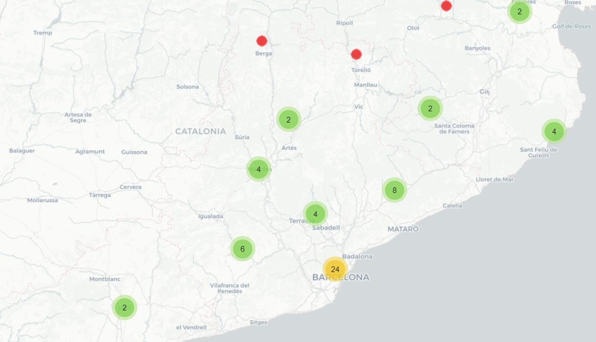
The Llargavista observatory consists of a website and an interactive map showing all registered cooperative housing initiatives in Catalonia (Spain), providing detailed information on each project obtained through questionnaires and interviews. Its objective is to disseminate the model and its evolution to all citizens in an accessible and understandable way.

Date

  • 2020: Implementation

Stakeholders

  • Promotor: Sostre Cívic
  • Coòpolis
  • Xarxa d'Economia Solidària
  • iLabSo
  • Risell

Location

Continent: Europe
City: Barcelona
Country/Region: Barcelona, Spain

Description

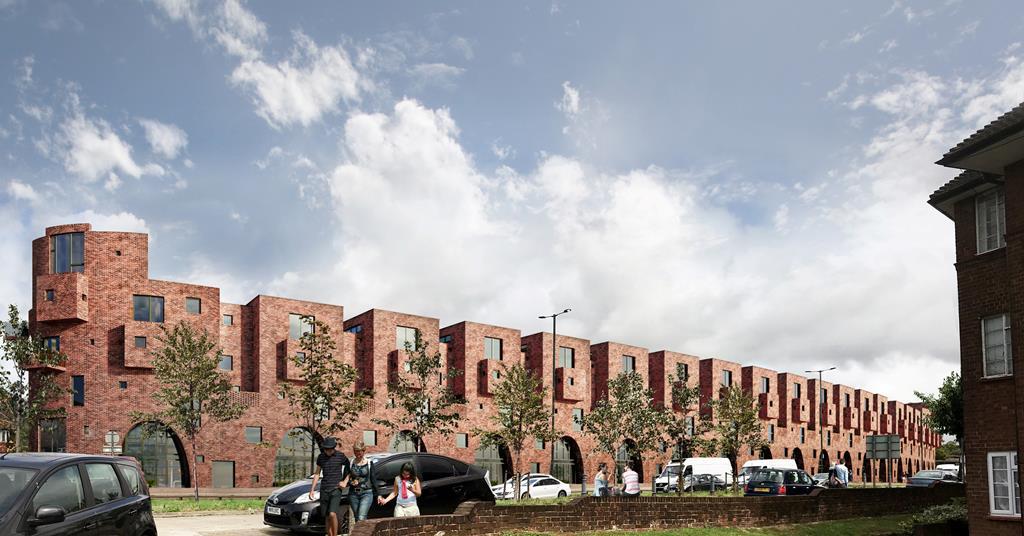
"Llargavista" means "long-term" in Catalan. This name is not accidental. The observatory seeks to map all cooperative housing in Catalonia, a nation within Spain, with the goal to make it a long-term solution for the housing crisis. Catalonia (and specifically Barcelona, its capital) has been a pioneer in a specific type of cooperative housing with “the right to use”. That is to say, the administration cedes the land in surface right to a cooperative, which constructs the building. After the period agreed with the cooperative, the building becomes public property. Thus, the cooperative never owns the land, but it does own the building for a certain agreed period of time. During that time, the people living in the housing must meet the requirements for access to public social housing and, in exchange for an entrance fee, be cooperative members. If they wish to leave the housing, they leave their share of the cooperative to whoever enters. The observatory monitors these initiatives.

This is an initiative promoted by Sostre Cívic, with the collaboration of Risell and iLabSo and the participation of the housing sector of the Xarxa d'Economia Solidària (XES) and the Cercle de transició ecosocial de Coòpolis. It is supported and financed by the General Directorate of Social Economy of the Generalitat de Catalunya and the Barcelona City Council. With the creation of this initiative, the aim is to observe the state and evolution of cooperative housing in cession of use throughout the country. At the same time, this tool is built with a long-term vision, to consolidate and grow cooperative housing as a transformative and non-speculative model of housing access and tenure.

The main objective is to carry out a quantitative and qualitative analysis of the cooperative housing sector in transfer of use, both of information related to the people and cohabitation units that participate, as well as the characteristics of the building or the project, and other elements of interest related to the project, such as economic and financial information or its social impact. This information, systematized and sustained over time, can be of interest to the cooperative housing sector, the academic world, public administrations and the media, among other agents. In addition, it aims to show the information in an accessible and understandable way in order to disseminate the model, the projects and their evolution to all citizens with a clearly informative function.

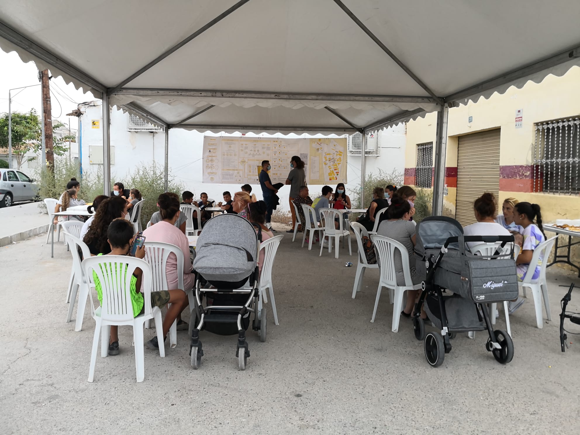
The main product of the observatory is a website and an interactive map that it incorporates, which shows all the registered cooperative housing initiatives in cession of use, with information on each project. The data is obtained through questionnaires answered by groups and projects throughout the country and through interviews with groups and various agents.

Transport for London housing units

0

Transport for London housing units

Mismatches Vulnerable groups Demographic/Urban growth
Policies and regulations Local policies Land Building capacity Governance
Promotion and production Public promotion Public-private partnerships

Main objectives of the project

London's housing crisis, marked by a lack of affordable homes and escalating prices, has been intensified by the city's rapid population growth. Middle-income families and key workers face significant challenges in finding affordable accommodation. Transport for London (TfL) responded by establishing a property development function in 2012, later expanded in 2016 to address the housing crisis. TfL plans to develop 10,000 homes on its landholdings, focusing on mixed-use developments near transport hubs. By autumn 2019, TfL had secured permission for 3,500 homes and planned to submit applications for over 6,000 more. TfL's strategy effectively combines affordable housing initiatives with revenue generation for public transportation, underscoring its dual benefits.

Date

  • 2016: Implementation

Stakeholders

  • Promotor: Transport for London

Location

Continent: Europe
City: London
Country/Region: London, United Kingdom

Description

The housing crisis in London represents a significant and ongoing challenge, characterized by a severe shortage of affordable homes and escalating property prices. Over the past few decades, the city's population has surged, driven by its status as a global economic hub and cultural capital. However, this rapid population growth has not been matched by an equivalent increase in housing supply, leading to a substantial imbalance.

As a result, many Londoners struggle to find affordable accommodation, with middle-income families and key workers particularly affected. The cost of both renting and buying homes has soared, pushing many residents to the outskirts of the city or even beyond. Additionally, the availability of social and intermediate housing has not kept pace with demand, exacerbating issues of overcrowding and homelessness.

In 2012, Transport for London (TfL) established a property development function aimed at optimizing the use of its landholdings to generate revenue for reinvestment into the city's transport network. In 2016, under the direction of a new mayor, this remit was expanded to address London's intermediate housing crisis. Thus, TfL was set to increase the amount of afforadble housing units in the city. The 75-person property development team at TfL is responsible for building communities through mixed-use developments around transport hubs, and for increasing the supply of social and intermediate housing units.

TfL owns 5,700 acres across London, primarily in outer London and near the transport network. The team has identified over 300 acres suitable for 10,000 homes, with 50 percent of the portfolio allocated for intermediate housing units. TfL employs various delivery models, including direct development, joint ventures, and disposals, collaborating with local authorities, landowners, and the broader development industry on a site-by-site basis.

By autumn 2019, TfL had secured permission for 3,500 homes and had an additional 1,180 homes submitted for planning. In the following six to nine months, it aimed to apply for more than 6,000 homes. To ensure the quality of development, all projects are reviewed by the Mayor’s Design Advocates before planning approval is sought. This projects are calles “Small Site, Small Builders”,because they are located in specific, yet little plots in the city. However their impacts are huge, solving one of the central issues in the public agenda of Londoners.

In Morden, a south London neighborhood, TfL has combined its landholdings with those of Merton Council to create a 20-acre development opportunity near Morden tube station. This scheme will be funded by Merton Council, TfL, and the GLA’s land fund. The goal is to create a new town center that reflects evolving trends in living, working, and leisure, based on the principle of healthy streets. Forty percent of the 1,070 new residential units will be affordable housing. The scheme also aims to enhance the attractiveness of the local center by connecting Morden with its surrounding green spaces.

TfL's strategy is exemplary as it not only promotes affordable housing but also generates revenue to support public transportation. Additionally, it integrates public transport and sustainable mobility as key features of future communities residing in its housing developments.

Apur interactive map on the evolution of social housing, Paris

0

Apur interactive map on the evolution of social housing, Paris

Policies and regulations Governance Data and monitoring Public-private initiatives Participatory processes

Main objectives of the project

Apur has developed an interactive map enabling citizens to monitor the evolution and development of social housing in Paris. The primary objective is to track progress towards achieving the city's goal of reaching 25% of rented social housing by 2025. This tool empowers citizens to visualize the distribution and growth of social housing units across different areas of Paris, providing transparency and accountability in the city's urban development initiatives.

Date

  • 2019: Implementation

Stakeholders

  • Apur

Location

Continent: Europe
City: Paris
Country/Region: France, Paris

Description

Apur, the Paris Urbanism Agency, is a non-profit association established in 1967 that brings together 29 partners. It serves as a collaborative platform for forward-looking, multi-scale studies, documenting, analyzing, and envisioning the urban and societal evolution of Paris, the 12 areas covered by Greater Paris Public Territorial Establishments, and the Grand Paris Metropolis as a whole.

Apur offers a tool that allows users to track the evolution of the number of social housing units, as defined by the SRU law, in Paris and in each district from 2001 to 2019, based on official counts. According to the SRU law, social housing units are counted annually by the State and the City of Paris. The law sets a goal for Paris to have 25% of rented social housing among main residences by 2025. As of January 1, 2019 (the latest official count), 21.4% of Parisian main residences were social housing as defined by the SRU law, compared to 13.44% on January 1, 2001, the first year the SRU law was implemented.

The tool also provides access to the locations of all social housing production operations financed between 2001 and 2018. During this period, over 104,484 social housing units were financed in Paris, with 6,257 of these being new social housing units financed in 2018 alone.

Pla de Barris, Barcelona

0

Pla de Barris, Barcelona

Mismatches Functional adequacy Services Cultural suitability Vulnerable groups Climate change
Policies and regulations Local policies Building capacity Global frameworks Governance Public-private initiatives

Main objectives of the project

The Pla de Barris in Barcelona adopts a holistic approach to affordable housing, emphasizing not only the refurbishment of housing and public spaces but also addressing economic and social justice issues within neighborhoods. Originating in the early 2000s and reimplemented in 2015 with a community-driven focus, the plan supports local initiatives with institutional help, fostering collective action. It integrates housing actions with economic development, educational opportunities, and social services to enable residents to afford their living costs. Currently, the AMB is preparing to expand this initiative to a metropolitan level, ensuring broader impact across the entire city.

Date

  • 2015: Implementation

Stakeholders

  • Foment de Ciutat
  • Ajuntament de Barcelona

Location

Continent: Europe
City: Barcelona
Country/Region: Barcelona, Spain

Description

When we speak about affordable housing, we often focus solely on the buildings. This brick-and-mortar perspective, while necessary, is only a small part of the whole issue. Dwelling is not just about having access to a housing unit with an affordable cost; it also involves having the opportunity to progress professionally and personally within the neighborhood, thereby being able to manage the cost of living. This is the logic behind "el Pla de Barris" (neighborhood plan) in Barcelona.

The Pla de Barris takes a holistic approach to addressing the needs of the most deprived areas in the city. While emphasizing the necessity of housing refurbishment and enhancement of public spaces, it also addresses the economic and social justice issues within neighborhoods. Thus, the plan combines housing initiatives with social policies.

The origin of the Pla de Barris dates back to the early 2000s, focusing on the need to foster investments in public spaces where vulnerable populations lived. However, after the 2008 crisis, the Pla de Barris was cut off due to budgetary reasons. In 2015, it was reimplemented with a different perspective. Now, the Pla de Barris is community-driven, centering on actions that the community can implement themselves with institutional support. Hence, it has transformed into a collective action policy. For example, despite its investment in housing refurbishment, it does so with a holistic approach. While the public administration typically just offers a grant, the Pla de Barris also provides the tools for the community to manage the grant and implement the project (see “Finques d’Alta Complexitat” on this same website).

Additionally, living in a neighborhood means having the earnings to pay for your house and expenses. For this reason, the latest Pla de Barris emphasizes the need to foster economic development projects, educational opportunities, and social services. In addition, it puts the climate resilience of housing and neighbourhoods as a central objective, adapting the most vulnerable to the climate challenge in their homes and environments.

The Pla de Barris operates within the municipality of Barcelona. However, the AMB, the metropolitan government, is now preparing the metropolitan Pla de Barris, so that investments can be scaled to the required dimension, impacting the entire city.

Observatoire de l'habitat, Luxembourg

0

Observatoire de l'habitat, Luxembourg

Mismatches
Policies and regulations Governance Data and monitoring Evaluation and impact

Main objectives of the project

Given the skyrocketing housing prices in Luxembourg, the Housing Observatory (Observatoire de l'habitat), established in 2003, plays a crucial role in informing housing policy and public awareness. It monitors property and land prices, analyzes housing dynamics, and studies socio-economic aspects of housing affordability. The Luxembourg Institute of Socio-Economic Research (LISER) partners with the Observatory to support its research and policy planning efforts.

Date

  • 2003: Implementation

Stakeholders

  • LISER (Luxembourg Institute of Socio-Economic Research)
  • Département du Logement du Ministère des Classes moyennes, du Tourisme et du Logement

Location

Continent: Europe
Country/Region: Luxembourg, Luxembourg

Description

Given the skyrocketing housing prices in Luxembourg, the establishment of a dedicated observatory has become crucial. In fact, Luxembourg has one of the most expensive housing markets in Europe. This poses a threat to its most vulnerable population. Thus, to solve it, the first step is to have the whole information about the housing situation.

In 2003, the Housing Observatory (Observatoire de l'habitat) was set up within the Housing Department of the Ministry of Small and Medium-sized Businesses, Tourism, and Housing to produce the information needed for effective housing policy planning and to inform the public about housing issues. Since its inception, its objective has been to collect, analyze, and disseminate information on housing. It also assists the Ministry of Housing and Spatial Planning in planning housing policy. The Housing Observatory is particularly responsible for monitoring property prices, rents, and land prices. Additionally, it analyzes land dynamics in the Grand Duchy of Luxembourg, conducts a census of building land for housing, and studies housing production dynamics. Furthermore, the Observatoire de l'Habitat examines the socio-economic aspects of housing issues, including housing affordability and the impact of public policies on housing costs.

The Luxembourg Institute of Socio-Economic Research (LISER) is a key partner of the Ministry of Housing and Spatial Planning in fulfilling the tasks of the Observatoire de l'Habitat. This public research center's mission is to conduct fundamental and applied research in the social sciences to advance knowledge, inform the actions of public authorities and socio-economic players, and educate society. Thus, as one of his objetives, is the responsible to collect and process the data of the Observatory. By doing so, a scientific approach is introduced to the Observatory. As a result, the open data can be consulted at their web regarding housing matters.

Système d'information géographique de la politique de la ville

0

Système d'information géographique de la politique de la ville

Mismatches Vulnerable groups
Policies and regulations Governance Data and monitoring Evaluation and impact

Main objectives of the project

The "SIG de la politique de la ville" is an advanced online atlas that provides detailed statistical data and monitors policy implementation in France's priority urban regeneration neighborhoods, ensuring effective tracking of housing affordability and urban deprivation.

Date

  • 2015: Implementation

Stakeholders

  • Ministère de la Transition écologique et de la Cohésion des territoires
  • Agence nationale de la cohésion des territoires

Location

Continent: Europe
Country/Region: France

Description

France has long recognized the challenges faced by its vulnerable urban areas and has taken proactive measures to ensure housing affordability while addressing the social issues in its most deprived neighborhoods. To effectively implement these measures, access to reliable information is crucial. This need led to the creation of the “SIG de la politique de la ville.”

The “SIG de la politique de la ville” is an online atlas that compiles statistical and policy information about the “quartiers prioritaires de la politique de la ville” (Priority Zones for City Policies). These are areas identified for active urban regeneration policies.

Before 2014, two distinct urban policy priority areas coexisted: the regulatory area, which generated tax benefits (known as the ZUS area), and the contractual area, which generated funding (or “Cucs” area). These intervention methods did not necessarily overlap. The law on programming for cities and urban cohesion, enacted on February 21, 2014, reformed the geographic prioritization of urban policy. Using income as the sole criterion, new priority neighborhoods were identified in mainland France, La Réunion, and Martinique through a detailed territorial grid. This method was adapted for the overseas territories and revised in 2024.

As a result, 200 priority neighborhoods were identified by the decree of March 27, 2015, focusing on areas with significant urban dysfunctions, which became priorities for the new national urban renewal program. In 2024, a new delimitation process is underway.

The SIG system monitors the implementation of renewal programs and tracks the evolution of statistical data in these neighborhoods. On the website, users can select an address or region to see the priority neighborhoods within that area. By selecting these neighborhoods, users can access 1) basic statistical information on urban deprivation, 2) details of implemented plans, and 3) the progress of these plans.

This SIG tool is among the most advanced systems globally for tracking neighborhood affordability and deprivation.

Downtown rehabilitation of Santiago de Compostela, Spain

0

Downtown rehabilitation of Santiago de Compostela, Spain

Mismatches Services Cultural suitability
Policies and regulations Local policies Global frameworks
Urban Design Modelos De Ciudad Urban fabrics Environments Quality Liveability

Main objectives of the project

Santiago de Compostela, the historic capital of Galicia, faces the challenge of rehabilitating its medieval centre, protecting its heritage and avoiding the displacement of residents due to the influx of pilgrims on the Camino de Santiago. Since the 1990s, a comprehensive programme has improved housing, facilities and public spaces, prioritising residential use and creating green corridors and pedestrian areas. These initiatives, financed in part by public-private partnerships, have raised the quality of life and fostered greater cultural identification and heritage conservation.

Date

  • 1994: Implementation

Stakeholders

  • Concello de Santiago de Compostela

Location

Continent: Europe
Country/Region: Spain

Description

Santiago de Compostela, the capital of Galicia, a region within Spain, is a medium-sized but ancient city. It has about 100,000 inhabitants. Known especially for being the final destination of the Camino de Santiago, Compostela is one of the main destinations for the Catholic community. This attracts many pilgrims and visitors, which has an impact on housing prices. This is particularly noticeable in its centre, where it faces the challenge of rehabilitating very old houses (some of medieval origin), protecting the heritage and ensuring that neighbours are not displaced. Hence, in the 1990s, a comprehensive rehabilitation programme was put in place, which sought to act on housing, neighbourhoods and neighbourhood support policies to enable a thriving city centre.

The main objective of the upgrading and recovery actions in the historic centre of Santiago has been to stabilise and improve the quality of life of the resident population. Therefore, the interventions have prioritised residential use as the central objective in the historic city, implementing comprehensive housing rehabilitation programmes.

These actions have been complemented by improvements in facilities and public space in various dimensions, such as the integration of peri-urban green spaces (corridors connecting the centre with the rural landscape) and the creation of a pedestrian priority zone. These strategies have increased the consideration of the centre as a meeting space. The strategic role of the historic centre as a space for residents is a topic of contemporary debate on historic centres which, in this case, has had a positive impact, contributing to improving the quality of the historic centre.

In addition, its environmental dimension is notable, with the integration of new green corridors in a compact historic environment, as well as the public-private partnership in its financing. Finally, the impact of the interventions has transcended the physical, as, together with the collaboration of a diverse network of agents, it has promoted the cultural identification of the heritage of the historic centre by the citizens, which has improved the quality of maintenance and a conscious use of the areas of the historic centre.

Polígono Sur, Sevilla, Spain

0

Polígono Sur, Sevilla, Spain

Mismatches Location Vulnerable groups
Policies and regulations Local policies Governance
Urban Design Modelos De Ciudad Urban fabrics Environments Quality Liveability

Main objectives of the project

The urban regeneration of Seville's Polígono Sur has been an ongoing process focused on revitalising one of the municipality's most vulnerable neighbourhoods. Actions include the improvement of housing, the urbanisation of abandoned areas, the creation of car parks and green spaces, and the improvement of accessibility. In addition, strategies have been implemented to encourage economic development through the incorporation of support facilities and training schemes. The improvement of public space has been key to promoting community identity and the integration of the neighbourhood with its surroundings.

Date

  • 2020: Implementation
  • 2006: Implementation

Stakeholders

  • Sevilla City Hall

Location

Continent: Europe
Country/Region: Seville, Spain

Description

The urban regeneration of Seville's Polígono Sur, a process that has been going on for a long time, has focused on revitalising one of the most vulnerable neighbourhoods in the municipality, both in socio-economic terms and in terms of the quality of the buildings. The first project was launched in 2006. After the pandemic of 2020, further phases are being implemented.

Ongoing actions in this area have covered various lines of intervention. Improvements have been made to housing and public spaces, urbanising derelict areas, creating new surface car parks and green spaces, and improving accessibility in existing areas. At the moment, a 'pon' rehabilitation of empty homes is being carried out, guaranteeing access to social housing for the people of the neighbourhood, and the so-called "Central Vacuum" is being redeveloped as a large green lung.

Other strategies have been aimed at promoting the economic development of the neighbourhood, through the incorporation of support facilities (which facilitate the development of business activities and the consolidation of existing ones) and the implementation of plans for training and integration of the neighbourhood with its surroundings.

The strategy of improving the public space is particularly relevant for its intention to promote the community identity of the beginnings of the neighbourhood and its spatial and social openness towards the surrounding areas.

Urban regeneration of the Albaicín, Granada

0

Urban regeneration of the Albaicín, Granada

Mismatches Cultural suitability Diversity
Policies and regulations Local policies Governance Public-private initiatives Participatory processes
Urban Design Environments

Main objectives of the project

The Albaicín, one of the most visited and touristically attractive neighbourhoods in Granada, has been a UNESCO World Heritage Site since 2007. However, its deteriorated state of conservation, with serious situations of substandard housing, led to the development of the Integral Rehabilitation of the Albaicín project in 2002. This project seeks to improve the living conditions of the residents and revalue the historical and architectural heritage, affecting 5,007 dwellings and combining the characteristics of the historical centre with urban growth. The plan promotes social and cultural diversity, gender equality and covers equipment, mobility and security needs, involving citizens in technical and administrative solutions.

Date

  • 2002: Implementation

Stakeholders

  • Granada City Hall

Location

Continent: Europe
Country/Region: Granada, Spain

Description

The Albaicín is a neighbourhood located in the centre of Granada. It is one of the most visited and most touristic, with a high heritage value, classified by UNESCO as a World Heritage Site since 2007. However, its state of conservation, including serious situations of substandard housing, motivated the development of the project for the Integral Rehabilitation of the Albaicín. This project, initiated in 2002, seeks to improve both the living conditions of the residents and to revalue and recover parts of the historical and architectural heritage.

To this end, the plan establishes a comprehensive intervention affecting 5,007 dwellings, combining the unique characteristics of the historic centre with the growth of the urban fabric. The plan also focuses on maintaining the social and cultural diversity of the ethnic minorities present in the neighbourhood and promoting gender equality, while considering the needs of the inhabitants in terms of facilities, mobility and perception of safety.

The uniqueness of both the urban landscape and the architectural typologies in an environment with a high identity value makes it necessary to incorporate citizen participation in order to implement feasible solutions at a technical and administrative level in cooperation with the neighbours. The creation of a regeneration office to accompany the inhabitants and other actors in the process has been key to the development of the plan.

All of this has allowed the establishment of a "culture of rehabilitation" that has made possible the realisation of projects of high architectural quality with an impact on a larger urban scale, as is the case of the Kuna House, an example of contemporary architecture rooted in the particularities of the place. Casa Kuna is a sustainable community space in the centre of Granada, revitalising an empty 150 m² space. The project focuses on the sale of recycled second-hand goods and local craft workshops, encouraging coexistence between vulnerable groups and residents of the Albaicín. It has created opportunities and improved neighbourhood relations through workshops and training, responding to the growing discontent in the neighbourhood.

Thus the project demonstrates not only the need for housing rehabilitation for vulnerable groups, but also the importance of opening up community spaces, where people can meet and work together. Moreover, to do so in a space where the circular economy is encouraged.

Asertos, Alicante

0

Asertos, Alicante

Mismatches Services Vulnerable groups
Policies and regulations Local policies Global frameworks Governance Participatory processes
Financing
Urban Design Modelos De Ciudad Urban fabrics Services and infrastructure Environments Quality Liveability Inclusion Equity
Promotion and production Favelas/Slums

Main objectives of the project

Asertos is a participatory local development programme originating in the Valencian Community, Spain. The aim is to accompany people and communities in vulnerable neighbourhoods in the improvement of their homes and streets. We use these material improvements to foster the construction of strong and self-sufficient communities.

Date

  • 2017: Implementation

Stakeholders

  • Architect: Quatorze
  • Architect: Arquitectos sin fronteras

Location

Continent: Europe
Country/Region: Alacant / Alicante, Spain

Description

In many regeneration projects in vulnerable neighbourhoods, there is little involvement of local residents. Generally, small spaces for participation are opened up or a superficial accompaniment is offered. In the end, the main objective is to rehabilitate a few houses. However, Asertos' radical vision is based on the idea that housing is only a means to build better, more inclusive and resilient communities. Therefore, they start from community action to promote new neighbourhoods.

The premise is that regeneration should not come from outside the neighbourhood. On the contrary, residents must be empowered to drive the regeneration of their homes and public spaces. In this way, external resources dedicated to the improvement of housing and common spaces also serve to reinforce the social cohesion of the community.

Assertions are accompanied by collective action and social involvement in order to develop specific projects that make it possible:
- Improve coexistence between neighbours through participation.
- Attend to the needs of the dwellings through comprehensive refurbishments driven by the residents themselves.
- Generate a local economy to teach trades, generate income, open up new economic opportunities or provide new jobs and resources to the community.

All this is based on the Asset-Based Community Development methodology, promoted in Europe by Nurture Development. Based on the discovery of the local resources that the community possesses (skills, passions, interests, places, associations, businesses, stories, etc.), we set up a Neighbourhood Resource Bank. With these ingredients, we work on identifying shared needs to connect and mobilise these resources. Through this process of community building, communities move towards a position of power and autonomy, avoiding excessive professionalism and welfarism, and gaining in health and well-being.

Thus, the aim is not only to rehabilitate housing, but also to generate a better and more robust economy, associative fabric and coexistence than when the project began.

It is one of the most radical community action projects ever carried out in Spain, applied to urban regeneration. Although the project began in the Alicante's "Barrio del Cementerio", they are now also working in other highly vulnerable parts of the city.