Mapping the vacant buildings of the center, Constanta, Romania
Main objectives of the project
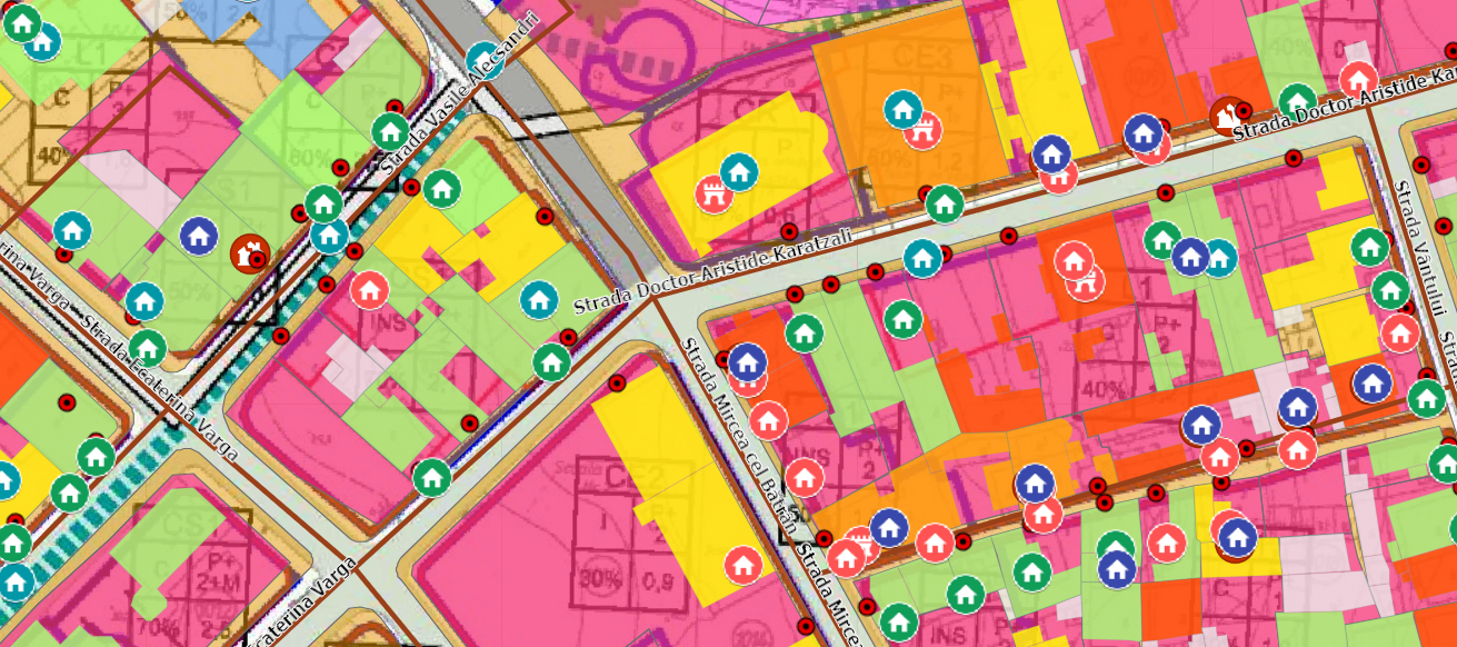
In Constanta's historic city center, there exists a notable abundance of deteriorated and unoccupied buildings. To systematically identify, catalog, and spatially represent these structures, as well as to devise and oversee strategies for their revitalization, Constanta has developed an urban planning database utilizing a Geographic Information System (GIS), specifically ArcGIS. Leveraging GIS enables the conduct of various analyses and the visualization of outcomes through mapping techniques. This database serves as a centralized repository for pertinent data concerning these buildings and their surroundings, facilitating access for key stakeholders.
Date
- 2018: Implementation
Stakeholders
- Constanta City Hall
Location
Country/Region: Constanța, Romania
Description
Constanta, the fourth largest city in Romania and a pivotal port on the Black Sea, boasts a rich history and serves as a prominent tourist destination and commercial hub. Despite its historical significance, the city has encountered a pressing issue within its core: the decline of its historic center, marked by dwindling population and numerous vacant buildings in urgent need of restoration. In response, the city initiated the ALT/BAU URBACT project to address this challenge head-on.
The initial hurdle was the lack of comprehensive data to guide solutions. To remedy this, a meticulous process was undertaken to compile a vast dataset encompassing every housing unit within the historic center. This involved collating diverse sources of information from various city departments, including urban development, heritage, local police, as well as public service and autonomous regimes governing public and private domains.
A crucial aspect of this data-gathering effort was the monitoring of building conditions and vacancy status. The local police department played a pivotal role in classifying and tracking degraded buildings, issuing notifications to owners and setting deadlines for rehabilitation. Failure to comply could lead to significant penalties, including increased property taxes of up to 500%.
Additionally, technical datasheets for each building were meticulously developed by volunteer junior architects and technical experts. These datasheets, enriched through field visits and collaboration with owners, contained vital information such as architectural style, construction year, and current condition.
The integration of this data into the ArcGIS desktop application platform facilitated systematic organization and regular updates, ensuring its accessibility to relevant stakeholders, particularly building owners.
Crucially, the database not only provided insights into building conditions but also encompassed broader contextual information essential for urban renewal efforts. This included infrastructure rehabilitation plans, municipal programs for building facades and roofs, as well as proposals from citizens, NGOs, and specialists.
As we briefly mention, leveraging this comprehensive dataset, the city implemented effective policies such as taxing vacant buildings. Through GIS-enabled classification, buildings were identified as either neglected, subject to fines without property tax increases, or neglected with potential tax hikes of up to 500%. The imposition of such measures incentivized rehabilitation efforts, prompting some owners to commence repair works or sell properties to willing investors.
Moreover, for listed buildings, collaboration with monument protection authorities ensured preservation and restoration measures were advised, underscoring the importance of heritage conservation within the urban renewal framework.
This case exemplifies how robust diagnosis and data-driven approaches can catalyze efficient policy interventions, revitalizing urban spaces and buildings, fostering affordable housing and preserving cultural heritage.